
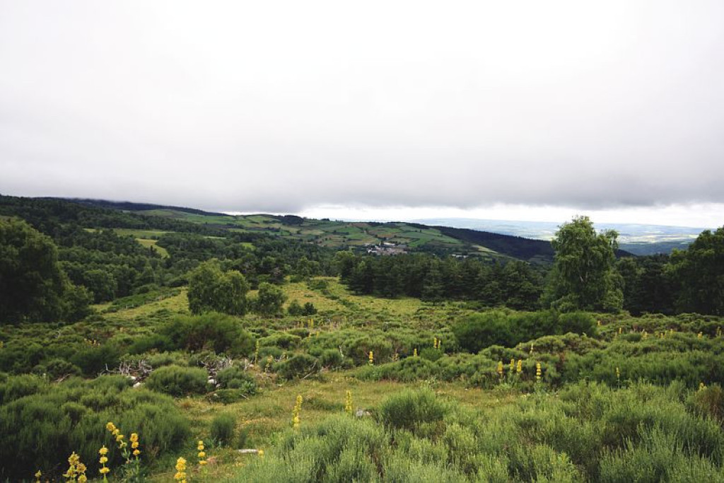
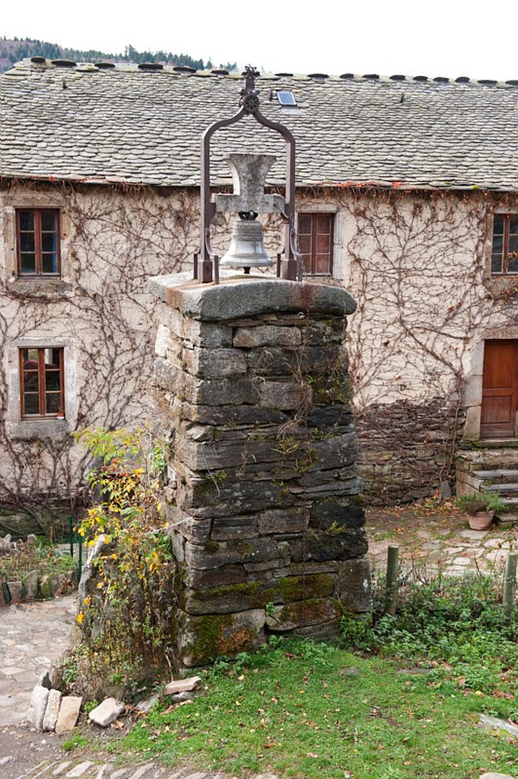
Blizzard belltowers keep you company throughout this trail over the large Mont Lozère peatbogs, the meadows of Les Espradels plateau and the “1,000 rivers” with their steep banks.
Les clochers de tourmente vous accompagnent tout au long de votre périple à travers les grandes tourbières du mont Lozère, les prairies du plateau des Espradels, et les "mille ruisseaux" aux berges étroites.

- Distance 22.89 km
- Elevation gain 870 m
- Elevation lost 870 m
- Min. elevation 918 m
- Max. elevation. 1371 m
- Duration (depending on pace) 8h30
- Suivre le balisage Yes

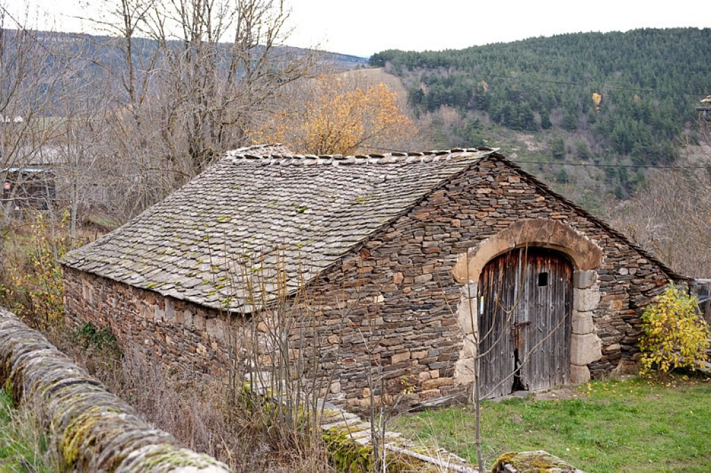
As you leave the hamlet of f Oultet, head towards Lozerette. Fork left onto the path to join up with the track to Lozerette. Take it to the right (do not go through Lozerette). As you cross Les Espadrels plateau, at the crossroads, continue straight ahead. Join up with the track to Serviès (do go to the hamlet of Serviès to see its blizzard belltower, then retrace your steps) and turn right towards les Sagnes. Keep going straight, across the plateau, and in Les Sagnes walk to the lower hamlet to see its blizzard belltower before doubling back. As you enter the hamlet, take the track on the left towards Croix de Peyrou. 150 m after the cross, continue straight ahead, then take the second path on the right, towards Auriac. Go through Auriac and then around the summit of Peyrou to the fork below La Felgère, at the menhir (standing stone). Take the right-hand path to go back downhill to Oultet.
Parking : As you leave Oultet
Get all the routes on your smartphone with the Lozère outdoor app. You'll find all outdoor activities (summer and winter seasons) and a host of functions :
- Take advantage of detailed IGN maps
- Download data for consultation even when you're not connected to the network
- Geolocate yourself at any time on the route and altimeter profile
- Activate the off-track alarm to be alerted if you stray from the itinerary
- Share your experience (add a report, share your lap time)...


the digital trails


![]()
The Lozère Outdoor application was created
by the Lozère Department
Infos & contacts
Conseil départemental de la Lozère
sportsnature@lozere.fr
+33(0)4 66 49 66 32
Crédits photos
 Lozère Outdoor - Parcours - The Clochers de Tourmente (Blizzard belltowers)
Lozère Outdoor - Parcours - The Clochers de Tourmente (Blizzard belltowers)
Lozère Outdoor - Parcours - The Clochers de Tourmente (Blizzard belltowers)
Lozère Outdoor - Parcours - The Clochers de Tourmente (Blizzard belltowers)
Lozère Outdoor - Parcours - The Clochers de Tourmente (Blizzard belltowers)

