
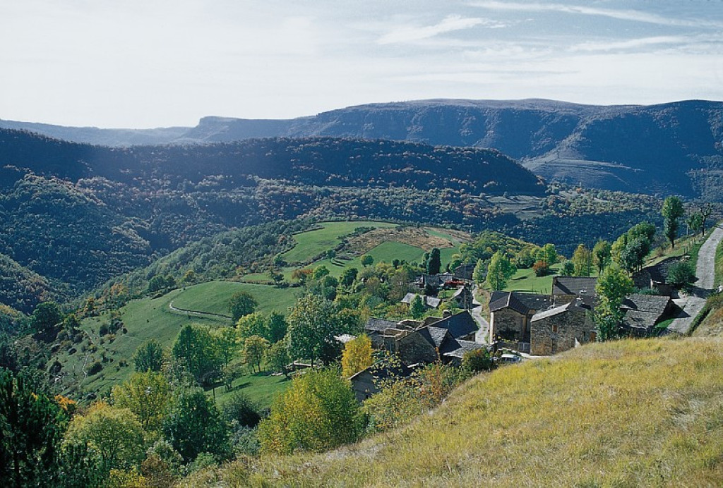
This circuit criss-crosses the Bramont valley, passing through wetlands and sweet-chestnut groves, and villages whose houses were built from limestone and schist.
- Distance 19.69 km
- Elevation gain 630 m
- Elevation lost 630 m
- Min. elevation 511 m
- Max. elevation. 1048 m
- Duration (depending on pace) 3h30
- Suivre le balisage Yes

Mountain-bike route # 6. Exit left from the car park and take the D 907 bis for 500 m, then take on your right a path alongside the river Tarn towards Le Cantonnet. Cross the D 907 bis and take the path on the valley floor to Pradines mill. Go uphill to Lonjagnes. N.B.: Do not enter the hamlet, but fork right beforehand towards Le Marazeil. As you exit Le Marazeil, go downhill on the road to Nozières. Cross the N 106 and take the road opposite towards Les Combettes. Go through the hamlet and continue on the track for about 1.7 km, then turn left onto a very small path to get back to Le Marazeil and Nozières. Cross under the N 106 and go downhill to Pradines mill/Le Cantonnet. Cross the N 106 and take a track along the Tarn to return to Ispagnac.
Parking : Car park opposite the pharmacy
Get all the routes on your smartphone with the Lozère outdoor app. You'll find all outdoor activities (summer and winter seasons) and a host of functions :
- Take advantage of detailed IGN maps
- Download data for consultation even when you're not connected to the network
- Geolocate yourself at any time on the route and altimeter profile
- Activate the off-track alarm to be alerted if you stray from the itinerary
- Share your experience (add a report, share your lap time)...


the digital trails


![]()
The Lozère Outdoor application was created
by the Lozère Department
Infos & contacts
Conseil départemental de la Lozère
sportsnature@lozere.fr
+33(0)4 66 49 66 32
Crédits photos
 Lozère Outdoor - Parcours - The Bramont Valley (by mountain-bike)
Lozère Outdoor - Parcours - The Bramont Valley (by mountain-bike)
Lozère Outdoor - Parcours - The Bramont Valley (by mountain-bike)
Lozère Outdoor - Parcours - The Bramont Valley (by mountain-bike)
Lozère Outdoor - Parcours - The Bramont Valley (by mountain-bike)

