A l'assaut de la Tour - VTT n°4
Add to my favorites

Route opened
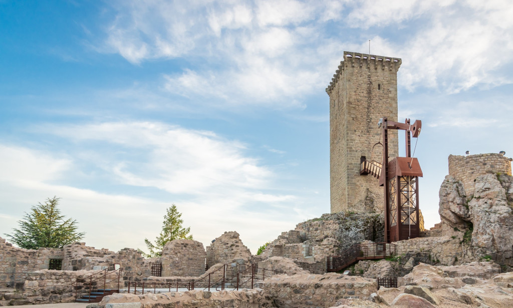
Au départ de Saint-Chély-d'Apcher, à travers prairies et forêts, partez à l'assaut de la tour. A son pied, découvrez les ruines du château d'Apcher, une des huit baronnies de Lozère et apprenez-en plus sur son histoire. Des tables de pique-nique seront aussi à votre disposition pour une pause bien méritée face aux monts de la Margeride.
Une boucle sportive de 22km sur de larges chemins.
The characteristics of the route.

Parking du Pontet, Saint-Chély-d'Apcher (48)
- Distance 24.51 km
- Elevation gain 540 m
- Elevation lost 540 m
- Min. elevation 940 m
- Max. elevation. 1109 m
- Duration (depending on pace) 2h30
- Suivre le balisage Yes

THIS ROUTE IN YOUR MOBILE PHONE
Download Lozère Outdoor app
Get all the routes on your smartphone with the Lozère outdoor app. You'll find all outdoor activities (summer and winter seasons) and a host of functions :
- Take advantage of detailed IGN maps
- Download data for consultation even when you're not connected to the network
- Geolocate yourself at any time on the route and altimeter profile
- Activate the off-track alarm to be alerted if you stray from the itinerary
- Share your experience (add a report, share your lap time)...

Add your time and share your feelings


Follow us on
the digital trails
the digital trails


![]()
The Lozère Outdoor application was created
by the Lozère Department
Infos & contacts
Conseil départemental de la Lozère
sportsnature@lozere.fr
+33(0)4 66 49 66 32
Crédits photos
 Lozère Outdoor - Parcours - A l'assaut de la Tour - VTT n°4
Hello, world! This is a toast message.
Lozère Outdoor - Parcours - A l'assaut de la Tour - VTT n°4
Hello, world! This is a toast message.
Lozère Outdoor - Parcours - A l'assaut de la Tour - VTT n°4
Hello, world! This is a toast message.


OK
Annuler