Saint-Flour valley
Add to my favorites

Route opened
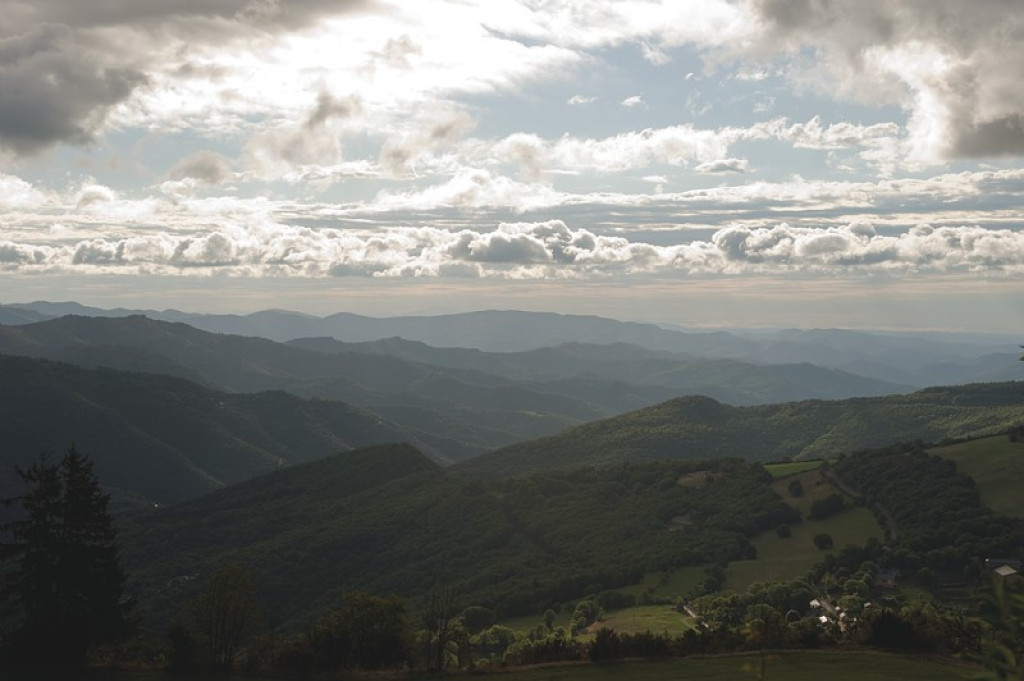
Zone de contact entre schiste et calcaire, avec un beau point de vue sur la vallée Française, marquée par des édifices aux murs de calcaire et aux toits en lauzes en schiste.
This is a contact zone between schist and limestone, with a picturesque viewpoint onto the Vallée Française and the characteristic limestone walls and schist roofs of its buildings.
The characteristics of the route.

Le Pompidou (place de la salle des fêtes) (48)
- Distance 4.93 km
- Elevation gain 230 m
- Elevation lost 230 m
- Min. elevation 621 m
- Max. elevation. 838 m
- Duration (depending on pace) 2h
- Suivre le balisage Yes

Start from the square in front of the community hall (Salle des fêtes).
1) Take the lane, then turn left to join the path that goes up to the Col de Tartabissac pass.
2) 50 m before you get to the pass, take a path on the right that goes down to the Maison de la Roquette. Turn left onto the D 62. 300 m further, leave the road to take a path on the right that goes downhill to La Coste.
3) At La Coste, turn right onto the road for 300 m and go uphill on a zigzagging path to the church of Saint-Flour du Pompidou.
4) Join the road that goes uphill to the village of Le Pompidou.
Parking : Below the mairie (town hall) / post office
Area : Cévennes et Mont Lozère
Report a problem
Pdf file THIS ROUTE IN YOUR MOBILE PHONE
Download Lozère Outdoor app
Get all the routes on your smartphone with the Lozère outdoor app. You'll find all outdoor activities (summer and winter seasons) and a host of functions :
- Take advantage of detailed IGN maps
- Download data for consultation even when you're not connected to the network
- Geolocate yourself at any time on the route and altimeter profile
- Activate the off-track alarm to be alerted if you stray from the itinerary
- Share your experience (add a report, share your lap time)...

Add your time and share your feelings


Follow us on
the digital trails
the digital trails


![]()
The Lozère Outdoor application was created
by the Lozère Department
Infos & contacts
Conseil départemental de la Lozère
sportsnature@lozere.fr
+33(0)4 66 49 66 32
Crédits photos
 Lozère Outdoor - Parcours - Saint-Flour valley
Hello, world! This is a toast message.
Lozère Outdoor - Parcours - Saint-Flour valley
Hello, world! This is a toast message.
Lozère Outdoor - Parcours - Saint-Flour valley
Hello, world! This is a toast message.


OK
Annuler