
Une balade entre les gorges de la Jonte et du Tarn ponctuée de magnifiques panoramas survolés par les quatre vautours européens présents dans les Grands Causses.
A walk between the Jonte and Tarn gorges, with panoramic landscapes and, in the skies above, the four European vulture species that live on the Grands Causses plateaux.

- Distance 11.57 km
- Elevation gain 590 m
- Elevation lost 590 m
- Min. elevation 397 m
- Max. elevation. 866 m
- Duration (depending on pace) 4h30
- Suivre le balisage Yes

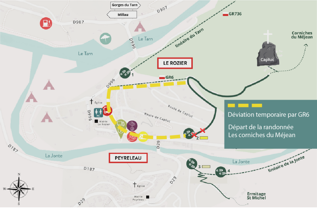
From the Place de la Mairie (town hall square) in Le Rozier, turn right then left in the village, and take the staircase between the houses on the left. Keep going uphill to the hamlet of Capluc.
1) At Capluc, you can choose to climb Capluc Rock (there and back, 30 min). If you do not, go past the bread oven and stay on the path that goes upstream in the Jonte gorge and continue to climb the hairpin bends of Echo Ravine. Ignore the path that goes downhill on the right.
2) At the crossroads, turn left and go uphill to the Col de Francbouteille pass.
3) At the pass, you go over into the Tarn valley. Turn right and take the path which more or less follows the contour line.
4) Turn right towards the Col de Cassagnes. At the first crossroads, go straight ahead, at the second turn right towards the Corniches de la Jonte.
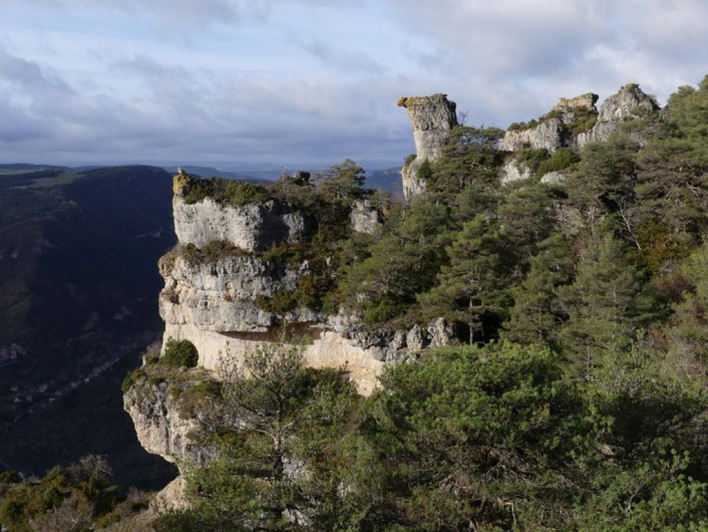
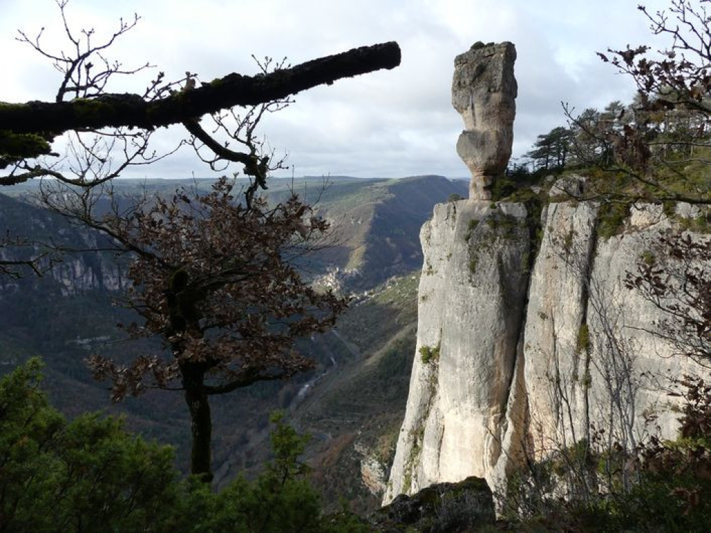
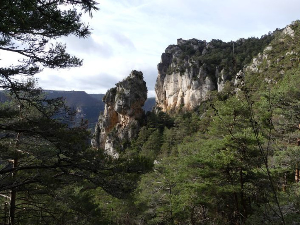
5) Here, the track becomes a path. This runs along the cliff edge, passing Balcon du Vertige, Pas du Loup, Vase de Chine and Vase de Sèvres.
6) At the crossroads, turn left to go down to Capluc, from where you return on the same path.
Parking : Car park in the village
Get all the routes on your smartphone with the Lozère outdoor app. You'll find all outdoor activities (summer and winter seasons) and a host of functions :
- Take advantage of detailed IGN maps
- Download data for consultation even when you're not connected to the network
- Geolocate yourself at any time on the route and altimeter profile
- Activate the off-track alarm to be alerted if you stray from the itinerary
- Share your experience (add a report, share your lap time)...


the digital trails


![]()
The Lozère Outdoor application was created
by the Lozère Department
Infos & contacts
Conseil départemental de la Lozère
sportsnature@lozere.fr
+33(0)4 66 49 66 32
Crédits photos
 Lozère Outdoor - Parcours - The cliffs of the Causse Méjean
Lozère Outdoor - Parcours - The cliffs of the Causse Méjean
Lozère Outdoor - Parcours - The cliffs of the Causse Méjean
Lozère Outdoor - Parcours - The cliffs of the Causse Méjean
Lozère Outdoor - Parcours - The cliffs of the Causse Méjean

