Biasses
Add to my favorites

Route opened
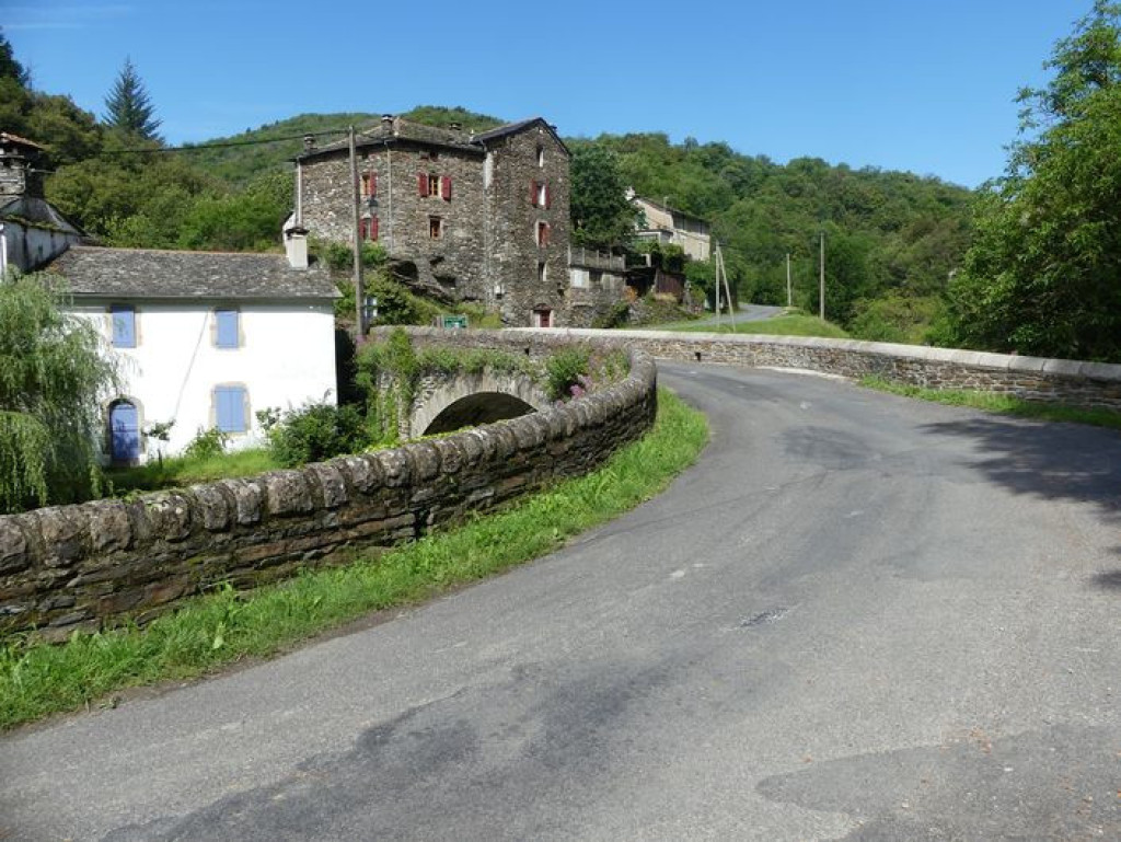
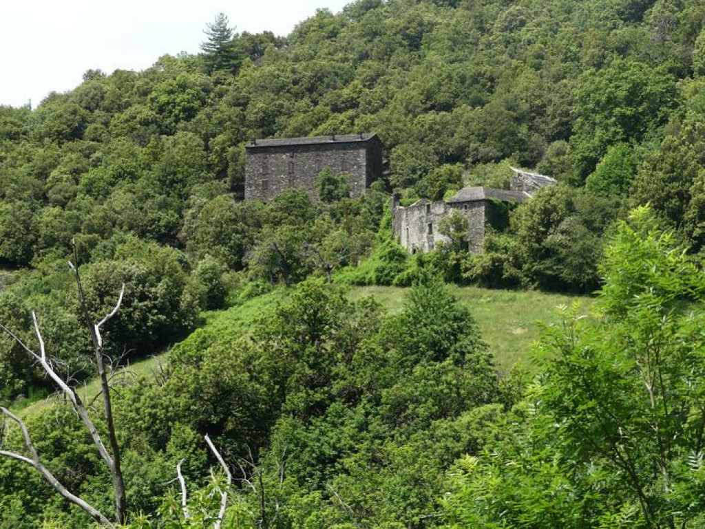
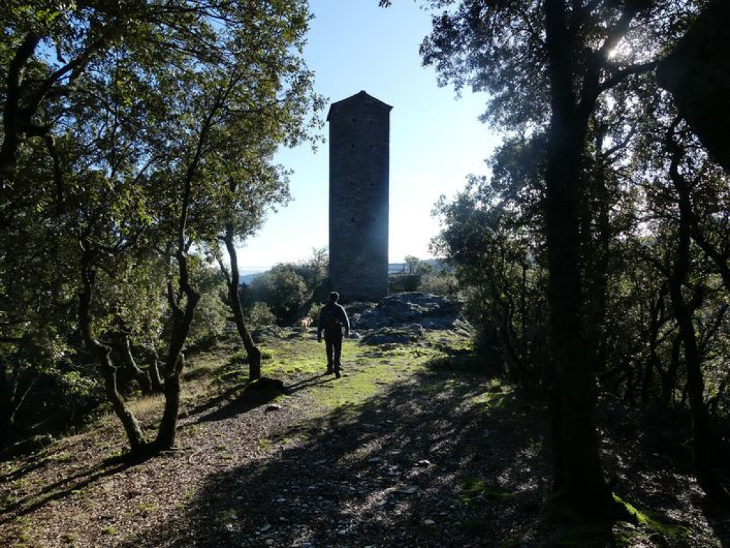
Le sentier traverse des hameaux typiquement cévenols dont l'imposante magnanerie de La Roque. Plantée fièrement sur son pic rocheux, la Tour de Canourgue garde la Vallée Française.
The path goes through typical Cevenol hamlets and passes near the imposing magnanerie (silkworm farm) of La Roque. On its rocky outcrop, La Canourgue tower proudly stands guard over the Vallée Française.
The characteristics of the route.

Au pont de Biasses (48)
- Distance 6.37 km
- Elevation gain 320 m
- Elevation lost 320 m
- Min. elevation 426 m
- Max. elevation. 619 m
- Duration (depending on pace) 2h30
- Suivre le balisage Yes

Departure from Biasses bridge.
1) Take on your right the concrete path, pass the “Barral” house, continue on the path that comes out near the hamlet of Bruguier-Bas, reach the D983, and cross it to take the path opposite that goes to the hamlet of Les Plantiers (under La Canourgue tower).
2) At the hamlet of Les Plantiers, first take the left then take the right the path that climbs to La Canourgue tower.
3) From the tower, retrace your steps to take the path on the right.
4) Pass below the house of Le Bruguier-Haut and join up with the road that you follow to Mazel Escassier. Just after the house, take the path on the right that leads to the D983. Turn right onto the road for 100 m. Take the road on the left for 540 m.
5) Take the path on the right towards the Magnanerie de La Roque.
6) Below the magnanerie, take the path on the left that descends to the hamlet of Le Castelet. Continue in the chestnut orchard to the valley floor. Join up with the road and turn right onto it to Biasses.
Parking : As you enter Biasses
Area : Cévennes et Mont Lozère
Report a problem
Pdf file THIS ROUTE IN YOUR MOBILE PHONE
Download Lozère Outdoor app
Get all the routes on your smartphone with the Lozère outdoor app. You'll find all outdoor activities (summer and winter seasons) and a host of functions :
- Take advantage of detailed IGN maps
- Download data for consultation even when you're not connected to the network
- Geolocate yourself at any time on the route and altimeter profile
- Activate the off-track alarm to be alerted if you stray from the itinerary
- Share your experience (add a report, share your lap time)...

Add your time and share your feelings


Follow us on
the digital trails
the digital trails


![]()
The Lozère Outdoor application was created
by the Lozère Department
Infos & contacts
Conseil départemental de la Lozère
sportsnature@lozere.fr
+33(0)4 66 49 66 32
Crédits photos
 Lozère Outdoor - Parcours - Biasses
Hello, world! This is a toast message.
Lozère Outdoor - Parcours - Biasses
Hello, world! This is a toast message.
Lozère Outdoor - Parcours - Biasses
Hello, world! This is a toast message.


OK
Annuler