
A taste of paradise...
In past centuries, these lands were much farmed. They are still brimming with fruit.
Yellow fruit ? Apple and pear trees gone wild are plentiful, and while their fruit are small, they are tasty.
Red fruit ? You can taste wild cherries, blackberries, blueberries or wild strawberries.
Nuts ? You can pick chestnuts as well as walnuts and hazelnuts.
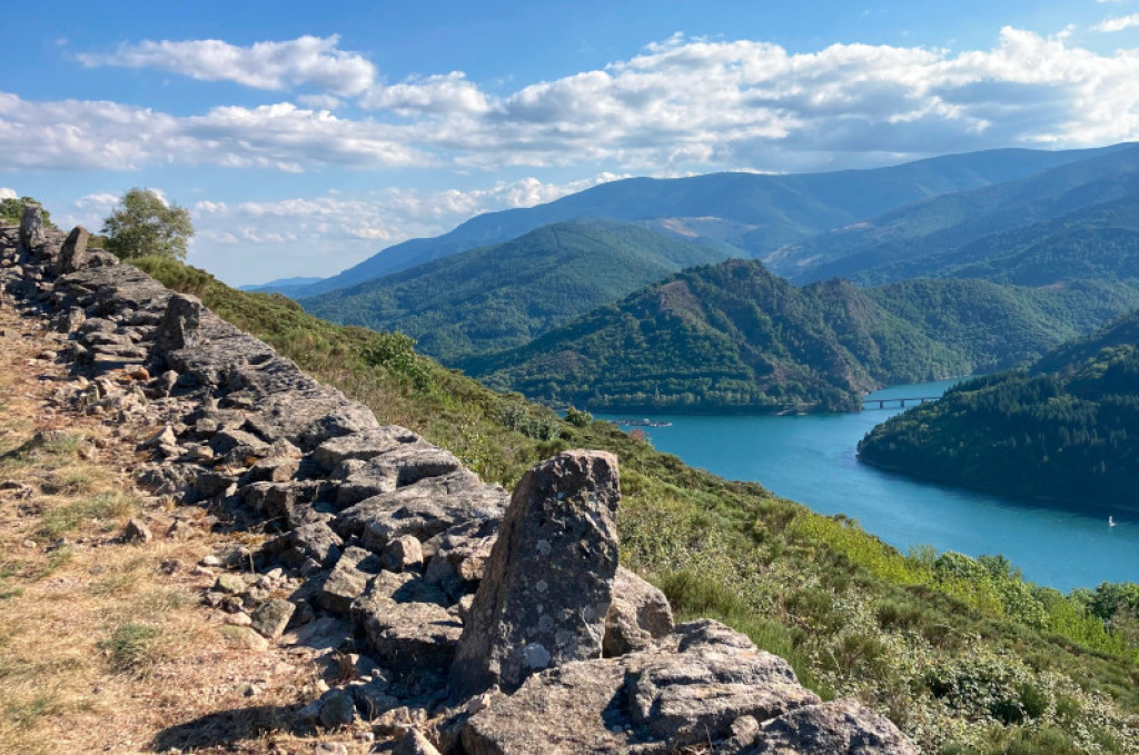
A long walk between Villefort lake and the plateau of La Garde-Guérin, with the Morangiès valley as backdrop.

- Distance 13.26 km
- Elevation gain 390 m
- Elevation lost 390 m
- Min. elevation 607 m
- Max. elevation. 926 m
- Duration (depending on pace) 4h
- Suivre le balisage Yes

Signposts will guide you all along this route. In the description below, the signposted place names and/or directions are given in bold italics between quotation marks :
From “Lac de Villefort”, walk towards :
- “Promontoire du lac”. At “Promontoire du lac”, go to :
- “POURCHARESSES” and then straight ahead to :
- “Col de la Violette”. At “Col de la Violette”, walk towards “LA GARDE-GUÉRIN” via :
- “Le Golf”,
- “Belvédère du Chassezac - parking”,
- “Chemin de la Fontaine”,
- “Porte du Rachas”.
- At “LA GARDE-GUÉRIN”, return to “Lac de Villefort”.
This hike is taken from the guidebook Mont Lozère - Pays des sources de la Margeride au lac de Villefort en Cévennes published by the Pôle de pleine nature du Mont Lozère.
Parking : Plage du lac de Villefort (Villefort lake beach)
Get all the routes on your smartphone with the Lozère outdoor app. You'll find all outdoor activities (summer and winter seasons) and a host of functions :
- Take advantage of detailed IGN maps
- Download data for consultation even when you're not connected to the network
- Geolocate yourself at any time on the route and altimeter profile
- Activate the off-track alarm to be alerted if you stray from the itinerary
- Share your experience (add a report, share your lap time)...


the digital trails


![]()
The Lozère Outdoor application was created
by the Lozère Department
Infos & contacts
Conseil départemental de la Lozère
sportsnature@lozere.fr
+33(0)4 66 49 66 32
Crédits photos
 Lozère Outdoor - Parcours - The cliffs of Pourcharesses
Lozère Outdoor - Parcours - The cliffs of Pourcharesses
Lozère Outdoor - Parcours - The cliffs of Pourcharesses
Lozère Outdoor - Parcours - The cliffs of Pourcharesses
Lozère Outdoor - Parcours - The cliffs of Pourcharesses

