
Panoramic views over the Cévennes, ascent of Pic Cassini, a stroll through an enchanted forest... This is a flamboyant trail – 100% joy.

- Distance 15.5 km
- Elevation gain 420 m
- Elevation lost 420 m
- Min. elevation 1379 m
- Max. elevation. 1678 m
- Duration (depending on pace) 1h45
- Suivre le balisage Yes


A pleasant wooded section to start off, to the Col du Pré de la Dame pass.
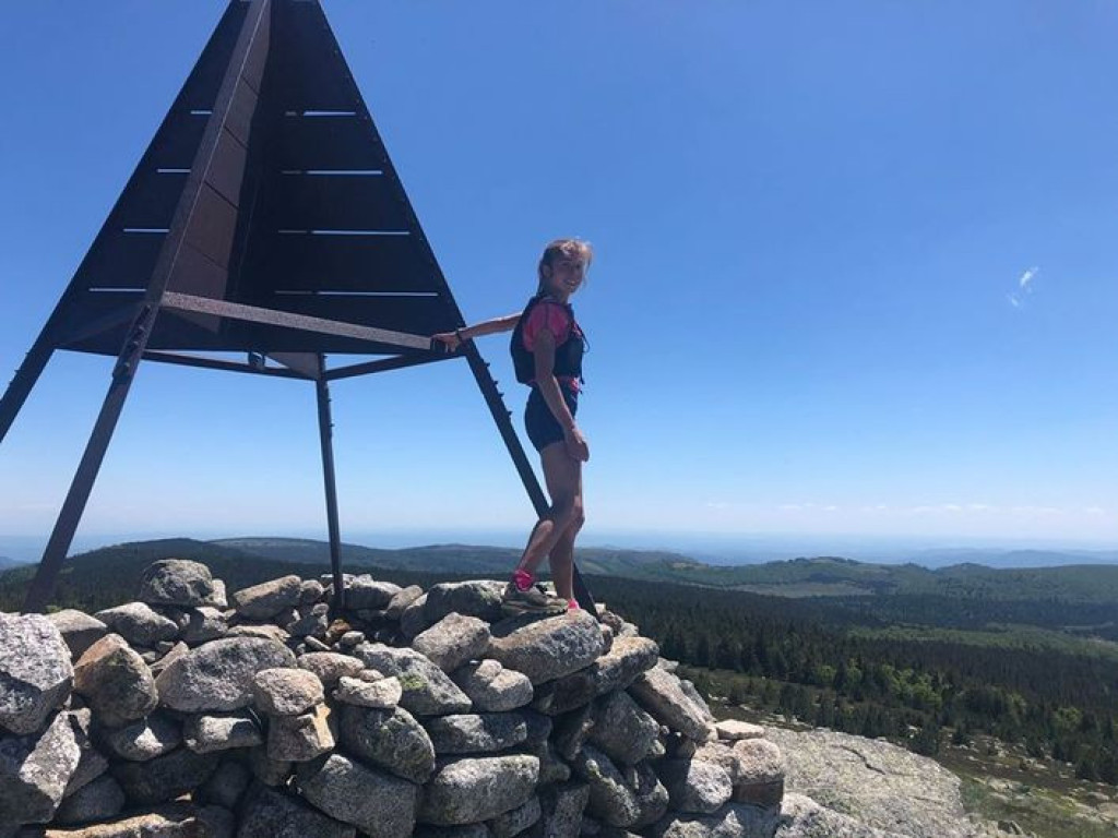
Then 3 km of gentle climbi on a pretty forestry track leads you to the Chalet de l'Aigle. Superb viewpoint over the Cévennes. A slightly steeper climb takes you to the top of Pic Cassini, at 1,680 metres the highest point on this trail. The route then goes gently downhill on magnificent paths. You finish on a trail in a fairy-tale forest.
Follow the waymarks for trail #19.
Signposts will guide you all along this route, as well as yellow painted waymarks. In the description below, the signposted place names and/or directions are given in bold italics between quotation marks:
From "Mas de La Barque" head towards:
- “Les Écuries de Mas de La Barque”,
- “Rochers de la Barque”,
- “Gardione” (2x),
- “Sous la roche fendue”,
- “La roche fendue”,
- “Lous Felzillas”. Then
- “Sous le chalet de l’Aigle" and
- “Chalet de l’Aigle”. Climb “Pic Cassini” via:
- “col de l’Aigle”.
- At “Pic Cassini” go to “Mas de La Barque” via:
- “Ravin de la Levade”,
- “Sous le pic de Cassini”,
- “Malpertus”,
- “Bois de Bellecoste”,
- “Gardièze”,
- “Martelet”, and “Mas de La Barque”.
This trail is taken from the guidebook Mont Lozère – Pays des sources, published by the Pôle de pleine nature du ont Lozère.
Parking : Mas de La Barque
Attention autour du Pic Cassini, présence possible de chien(s) de protection (patou), adaptez votre comportement.
Avant de vous engager sur un circuit, vérifiez qu'il est adapté à votre activité et à votre niveau. N'oubliez pas que le temps change vite en montagne. Refermez bien les clôtures et les portillons. Restez sur les chemins balisés.
Get all the routes on your smartphone with the Lozère outdoor app. You'll find all outdoor activities (summer and winter seasons) and a host of functions :
- Take advantage of detailed IGN maps
- Download data for consultation even when you're not connected to the network
- Geolocate yourself at any time on the route and altimeter profile
- Activate the off-track alarm to be alerted if you stray from the itinerary
- Share your experience (add a report, share your lap time)...


the digital trails


![]()
The Lozère Outdoor application was created
by the Lozère Department
Infos & contacts
Conseil départemental de la Lozère
sportsnature@lozere.fr
+33(0)4 66 49 66 32
Crédits photos
 Lozère Outdoor - Parcours - Chalet de l'Aigle and Pic Cassini, Trail #19.
Lozère Outdoor - Parcours - Chalet de l'Aigle and Pic Cassini, Trail #19.
Lozère Outdoor - Parcours - Chalet de l'Aigle and Pic Cassini, Trail #19.
Lozère Outdoor - Parcours - Chalet de l'Aigle and Pic Cassini, Trail #19.
Lozère Outdoor - Parcours - Chalet de l'Aigle and Pic Cassini, Trail #19.

