
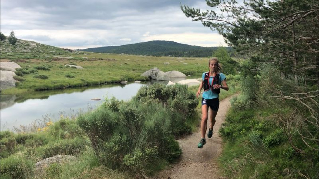
Magnificent panoramic views over the Cévennes, typical Mont Lozère hamlets and, as a bonus, perfect bathing spots make for a trail to enjoy without moderation.
Magnificent panoramic views over the Cévennes, typical Mont Lozère hamlets and, as a bonus, perfect bathing spots make for a trail to enjoy without moderation.

- Distance 18.34 km
- Elevation gain 620 m
- Elevation lost 620 m
- Min. elevation 898 m
- Max. elevation. 1370 m
- Duration (depending on pace) 2h30
- Suivre le balisage Yes

The trail starts in the village, with a steep climb for a few hundred metres, then continues on a narrow path. Once you reach the hamlet of Villeneuve, most of the climb is done!
Then you follow a small lane to the hamlet of L’Hôpital, before taking a sandy track that leads you to the Pont du Tarn. The last part of the trail is on the GR® long-distance hiking path, a pleasant route that runs alongside the Tarn. The first section of the descent is a little technical but also magnificent. The last two kilometres are identical to the first two.
Follow waymarks for #23.
Signposts will guide you all along this route, as well as yellow painted waymarks. In the description below, the signposted place names and/or directions are given in bold italics between quotation marks:
From "Pont de Montvert", go towards "L'Hôpital" via :
- "Quartier de la Barte",
- "La Barte",
- "Prat del Lach",
- "L'Avès",
- "Villeneuve > 2km",
- "Pont de Planche",
- "Gasbiel",
- "L'Hôpital - Commanderie". Then head for "Pont du Tarn" via
- "Prat Redoun".
- From "Pont du Tarn", return to "Pont de Montvert" via
- "Gap Francès",
- "La plaine du Tarn",
- "Bois de la Mouline" (2x),
- "Le Merlet",
- "Lou Mouly",
- "L'Avès", then return to "Pont de Monvert" via "Prat del Lach", "La Barte", "Quartier de la Barte".
This trail is taken from the guidebook Mont Lozère - Pays des sources, published by the Pôle de pleine nature du mont Lozère.
Parking : Car park at the Temple (Protestant church)
En haute saison, stationnement difficile dans le village; privilégiez le parking indiqué en sortie du village.
Avant de vous engager sur un circuit, vérifiez qu'il est adapté à votre activité et à votre niveau. N'oubliez pas que le temps change vite en montagne. Refermez bien les clôtures et les portillons. Restez sur les chemins balisés.ans le village ; privilégier le parking i
Get all the routes on your smartphone with the Lozère outdoor app. You'll find all outdoor activities (summer and winter seasons) and a host of functions :
- Take advantage of detailed IGN maps
- Download data for consultation even when you're not connected to the network
- Geolocate yourself at any time on the route and altimeter profile
- Activate the off-track alarm to be alerted if you stray from the itinerary
- Share your experience (add a report, share your lap time)...


the digital trails


![]()
The Lozère Outdoor application was created
by the Lozère Department
Infos & contacts
Conseil départemental de la Lozère
sportsnature@lozere.fr
+33(0)4 66 49 66 32
Crédits photos
 Lozère Outdoor - Parcours - Pont du Tarn, Trail #23
Lozère Outdoor - Parcours - Pont du Tarn, Trail #23
Lozère Outdoor - Parcours - Pont du Tarn, Trail #23
Lozère Outdoor - Parcours - Pont du Tarn, Trail #23
Lozère Outdoor - Parcours - Pont du Tarn, Trail #23

